MAPPING SERVICES
Information on FRWA Mapping Services
Why Map Your System?
Keeping accurate maps of your water and wastewater systems is more important than ever. Experienced operators are retiring, and with them goes knowledge about system layouts and key asset locations. Meanwhile, systems keep expanding, and it can be hard to keep track of everything.
Accurate maps show the locations of mains, valves, hydrants, tanks, treatment plants, and other important infrastructure, all in one place. This helps everyone—from operators to management—understand the system at a glance.
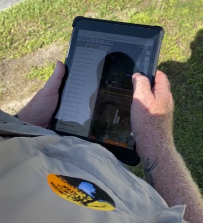
How GPS Helps
Using GPS to collect system data makes it easy to create digital maps with precise locations for all your assets. This can include wells, valves, hydrants, mains, manholes, and lift stations. With this information stored electronically, you can quickly access, update, and share system data, saving time and reducing errors.
Electronic maps make it easy to print maps, track assets, manage valve programs, and monitor sample points or flushing locations. They also help with planning future improvements and responding quickly in emergencies by providing exact locations when every minute counts.
How FRWA Can Help
FRWA staff handle the mapping for member systems at no cost to the system, using advanced GPS equipment and mapping software to create accurate, detailed digital maps and data files. This ensures your system information is precise, up-to-date, and professionally managed without any extra work or equipment needed from your team.